
One of the many great pleasures of living in the West Harbour neighbourhood is the history of the area. On a snowy, icy December afternoon, you may want to peruse the website of the Oakville Historical Society. They have posted to their website a large collection of photos and documents relevant to our area.
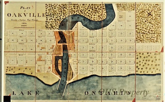
Check out the map of Oakville from 1836, with nearly every lot and road as it is today. Lakeshore Road was originally Colborne Road, but otherwise the map looks very similar to today. You can acquire a copy of this map, and others, at the Oakville Historical Society offices.
An example of West Harbour from their excellent photo library:
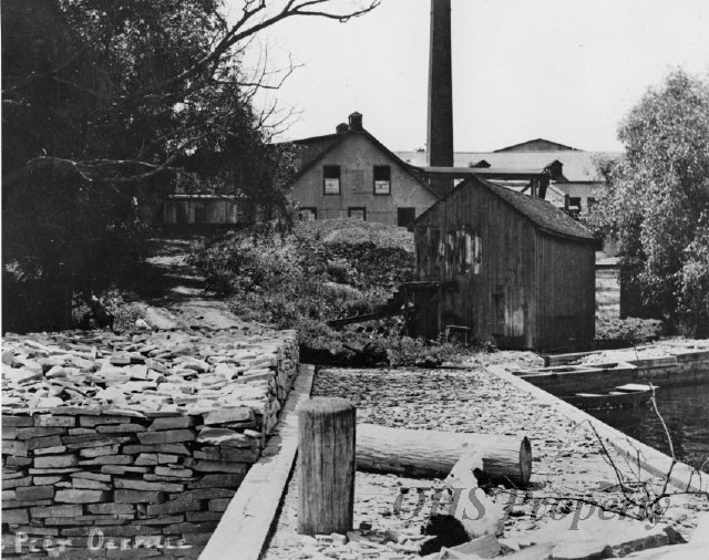
From their website:
“This is the Old Tannery located at the West Pier on Sixteen Mile Creek. It was built in 1836 as a brewery and distillery. The stones on the left of the picture were piled by stonehookers in 1900. Used as a postcard.”
All images used with permission of the Oakville Historical Society.